EGDI Metadata
Map
Help
Cookies
Contact
English
Login
Basic
Full
metadata
Borehole surveys
Metadata language
Abstract
ArcGIS Server Service gives access to key information about drilling and objects registered in the descriptive database of geological objects.
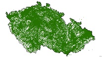
Browse Graphic
Type
service - služba
Resource Locator
ArcGIS Server service (CS)
Identifier
https://registry.geology.cz/id/GDO-PRZ-SDE-SER
Service Type
ESRI_MAP
Keywords
ISO 19119:
Geographic viewer
CGS Geoscientific themes:
geology
geological surveys
geophysics
hydrogeology
state geological service
material documentation
GEMET - Concepts, version 3.1:
science/natural science/earth science/geology
science/natural science/earth science/geology/hydrogeology
science/natural science/earth science/geophysics
GEMET - INSPIRE themes, version 1.0:
Spatial scope:
National
Free:
borehole
CzechGeo
EGDI
Bounding box
11.5826888350148, 47.8179698239719, 19.00421903453, 51.357105092337
Region
Česká republika
Date
creation: 2012-05-24
Temporal extent
1970-01-01 - now
Contact Info
Czech Geological Survey
Ing. Martin Paleček
Leitnerova 204/22
,
Brno
,
602 00
,
Česká republika
https://cgs.gov.cz/personal/martin-palecek
tel: +420543429261
email:
[email protected]
Role:
point of contact
Czech Geological Survey
Klárov 131/3
,
Praha 1
,
118 00
,
Česká republika
https://cgs.gov.cz
tel: +420257089411
email:
[email protected]
Role:
custodian
Data Quality
Conformity
INSPIRE - Network services 976/2009
Constraints
Access and use conditions
no conditions apply
Copyright (All Rigths Reserved)
Limitations on public access
no limitations to public access
Metadata about metadata
Metadata identifier
5af2f5b4-4784-4ef0-a890-7ec80a010852
Metadata Contact
Czech Geological Survey
Mgr. Pavla Kramolišová
Kostelní 364/26
,
Praha 7
,
170 00
,
Česká republika
https://cgs.gov.cz/personal/pavla-kramolisova
tel: +420 234 742 161
email:
[email protected]
Role:
point of contact
Date Stamp
2024-01-12
Coupled Resource
Used in
Borehole surveys
Resources used
Borehole surveys