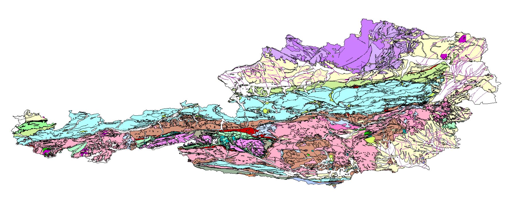
Geological Base Map of Austria 1:500,000 - WMS


This view service provides a generalized representation of the geological units and tectonic structures of Austria at a scale of 1:500,000. It supports geoscientific analysis, spatial planning, and thematic visualization by enabling standardized web-based map access to the Geological Base Map of Austria.
service
- Dienst
view
1.3.0
Art des Geodatendienstes:
ISO 19119:
GEMET - INSPIRE themes, version 1.0:
 Spatial scope:
European Geoscience Registry - Projects:
EGDI Keyword Thesaurus:
EU Vocabulary – Country (EU Publications Office):
Spatial scope:
European Geoscience Registry - Projects:
EGDI Keyword Thesaurus:
EU Vocabulary – Country (EU Publications Office):
tectonics
geologic unit
Free:
base map
Lithology
Chronostratigraphy
Vector data
GeoSphere
InventoryGM
9.529999999999999,
46.37,
17.16,
49.02
publication: 2023-11-06, revision: 2026-03-05
completed
GeoSphere Austria
email:
[email protected]
Role: point of contact
Data Quality
Constraints

No limitations on public access
Metadata about metadata
54434282-5350-4b91-b6e6-ed2a0bb4ca71
GeoSphere Austria
Hohe Warte 38,
Wien,
1190,
Österreich
email:
[email protected]
Role: point of contact
GeoSphere Austria
Werner Stöckl
email:
[email protected]
Role: point of contact
2026-05-27