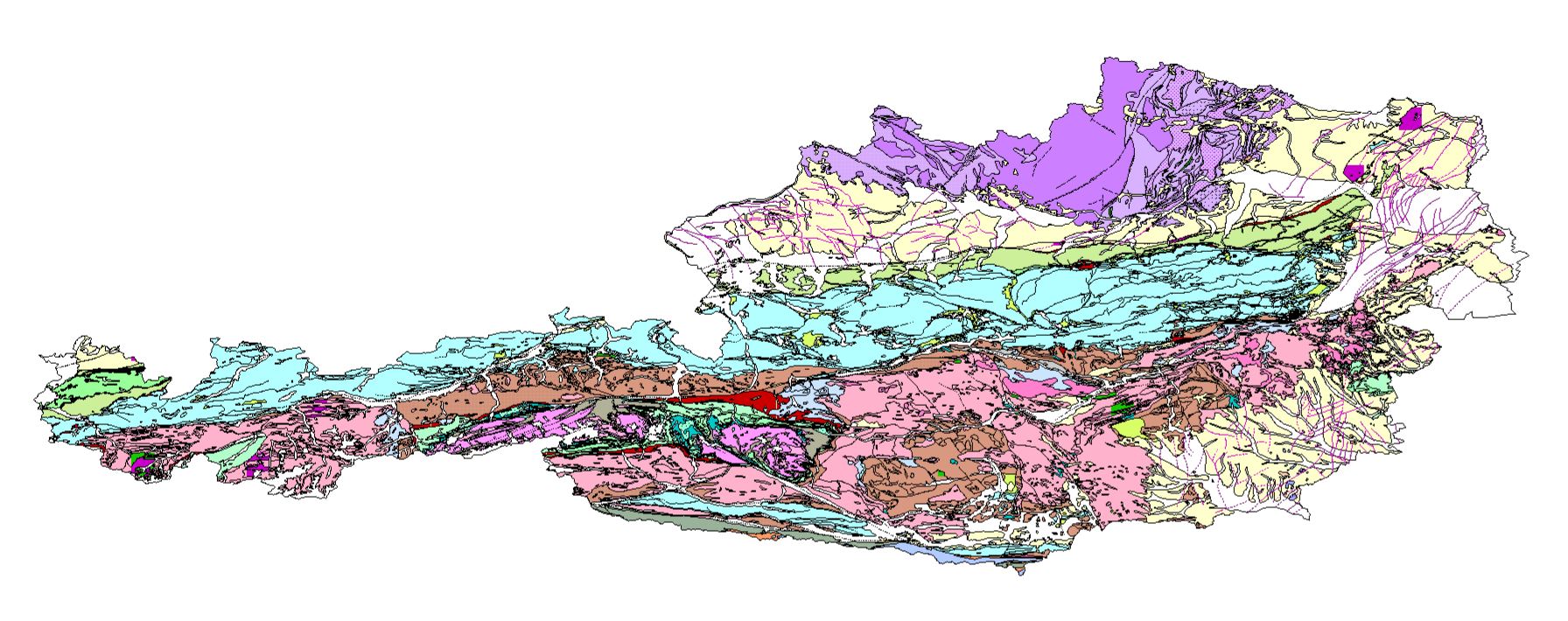
Geological Base Map of Austria 1:500,000


The Geological Base Map provides a generalized representation of Austria’s geologic units and tectonic structures. The dataset is based on the analog publication Metallogenetische Karte von Österreich (Weber, 1997) and has been prepared for use in GIS applications without modifying the original geological content. Minor corrections address indexing errors in volcanic rocks west of Güssing. This dataset serves as a reference for regional and supraregional geoscientific analyses and applications.
dataset
Geological Base Map of Austria 1:500,000 - MPKX
- Download as ArcGIS Map Package (*.mpkx)
GeoSphere Tethys
- Tethys Research Data Repository
Literature
- Library of GeoSphere Austria
:
13c81311-bf76-4749-8235-874040d77acd
German
Geoscientific information
GEMET - INSPIRE themes, version 1.0:
 Spatial scope:
European Geoscience Registry - Projects:
EGDI Keyword Thesaurus:
EU Vocabulary – Country (EU Publications Office):
Spatial scope:
European Geoscience Registry - Projects:
EGDI Keyword Thesaurus:
EU Vocabulary – Country (EU Publications Office):
Free:
base map
Lithology
Chronostratigraphy
Vector data
GeoSphere
InventoryGM
9.534000000000001,
46.407,
17.166,
49.019
publication: 1997-01-01, revision: 2025-12-03
1997-01-01
-
1997-12-31
completed
vector
Generalized representation of the geologic units and tectonic structures of Austria for geoscientific analysis and planning.
GeoSphere Austria
Hans-Georg Krenmayr
email:
[email protected]
Role: point of contact
Data Quality
The service is based on the Geological Base Map 1:500,000 in the national standard model. It serves as the basis for the transformation into the INSPIRE data model (Theme Geology). While this service maintains the full semantic depth of the national model, the INSPIRE version is optimized for cross-border interoperability.
Data Source: GeoSphere Austria (2025): Geodaten – Geologische Basiskarte der „Metallogenetischen Karte von Österreich“ (1:500.000). Tethys RDR, GeoSphere Austria, Wien ( https://doi.org/10.24341/tethys.255 ).
Data Source: GeoSphere Austria (2025): Geodaten – Geologische Basiskarte der „Metallogenetischen Karte von Österreich“ (1:500.000). Tethys RDR, GeoSphere Austria, Wien ( https://doi.org/10.24341/tethys.255 ).
Equivalent Scale:
1:
500000
Constraints

No limitations on public access
Metadata about metadata
13c81311-bf76-4749-8235-874040d77acd
GeoSphere Austria
Hohe Warte 38,
Wien,
1190,
Österreich
email:
[email protected]
Role: point of contact
GeoSphere Austria
Werner Stöckl
Hohe Warte 38,
Wien,
1190,
Österreich
email:
[email protected]
Role: point of contact
2026-05-27