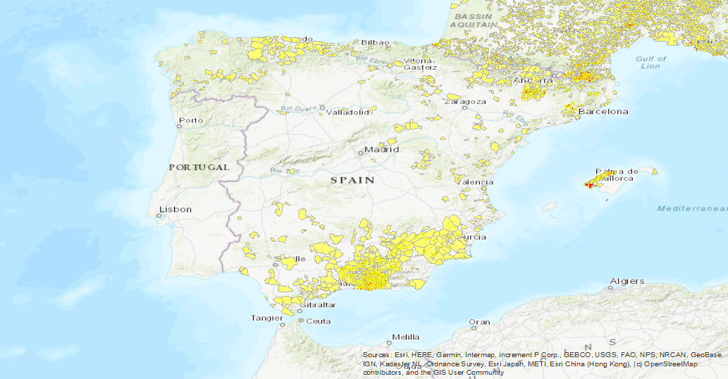
EGS Landslide Density Database


The first layer is a Landslide density map (LANDEN). The second layer is an average landslide density for each administrative area. A detailed explanation of these layers can be found in: Herrera, G., Mateos, R. M., García-Davalillo, J. C., Grandjean, G., Poyiadji, E., Maftei, R., ... and Trigila, A. (2017). Landslide databases in the Geological Surveys of Europe. Landslides, 1-21.https://doi.org/10.1007/s10346-017-0902-z.
large_thumbnail
dataset
- http://egdi.geus.dk
IGME-CSIC
:
BDDESLIZAMIENTOSEDGI
Spanish
Geoscientific information
ISO - 19119 geographic services taxonomy, 1.0:
GEMET - INSPIRE themes, version 1.0:
 IGME Thesaurus:
Spatial Scope:
IGME Thesaurus:
Spatial Scope:
Landslide
Density
Europe
EGS
HumanGeographicViewer
Natural hazard
Free:
Geohazards
Free:
EGDI
-55.83,
23.91,
68.1,
76.43
publication: 2018-02-19
2018-02-19T10:00:00
completed
vector
To elaborate an European landslide density map
EuroGEoSurveys: Earth Observation-GeoHazards
Juan Carlos García Lopez-Davalillo
C/Calera, 1,
Madrid,
28003,
España
tel: (+34) 91 349 5784
email:
[email protected]
Role: custodian
Data Quality
Landslide density Database: The available landsliderecords where transformed into a point layer. Landslides mapped as polygons were converted into points calculating their centroids. The 1-km reference grid from the European Environment Agency (EEA) was used to calculate the landslide density for every 1km2. Landslide density for each administrative area: The average landslide density per administrative area is calculated using the municipal administrative boundaries provided by 10 Geological Surveys, and for the other 7, the lowest administrative level avaliable from the Global Administrative Areas (GADM 2015) is used.
COMMISSION REGULATION (EC) No 1205/2008 of 3 December 2008 implementing Directive 2007/2/EC of the European Parliament and of the Council as regards metadata
Constraints
LICENSE OF USE: Conditions of public use and dissemination of information for the reuse of data. https://www.igme.es/condiciones-de-uso/
Metadata about metadata
ESPIGMEBDDESLIZAMIENTOSEDGI20180323
Geological Survey of Spain (IGME-CSIC)
Leticia Vega Martín
,
Madrid,
28003,
España
tel: +34 91 349 57 00
email:
[email protected]
Role: point of contact
2025-08-06