Map based index (GeoIndex) mineral occurrences

This layer of the map based index (GeoIndex) shows the locations of known mines, mineral showings and localities, including sites where minerals of economic interest have been identified in panned concentrates. The information for the index is taken from the Mineral Occurrence Database. The Mineral Occurrence Database holds information on mineral occurrences in the UK including locations of known mines, deposits, prospects and mineral showings, including sites where minerals of potential economic interest have been identified in panned concentrates. Data is normally taken from published sources or from internal BGS records, such as field sheets, rock and stream sediment collection cards. Data compilation started ca. 1994 and the database currently holds about 13 000 records, but details of many more old workings and occurrences remain to be added.
dataset
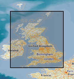
GeoIndex Onshore: Mineral Occurrences
- BGS GeoIndex is a web tool for professional users who need to access BGS data as part of their business requirements. The map viewer is free to use and is designed to work on desktop and mobile devices.
GeoIndex_Onshore_minerals_wms
- One or more layers for the dataset is provided through this OGC WMS (view) service. This URL is the service end-point and is intended for consumption by software clients that understand the WMS API.
GeoIndex_Onshore_minerals_wms
- One or more layers for the dataset is provided through this OGC WMS (view) service.
:
http://data.bgs.ac.uk/id/dataHolding/13605477
English
Geoscientific information
GEMET - INSPIRE themes, version 1.0:
 BGS Thesaurus of Geosciences:
Minerals
Ores
Mines
Free:
NERC_DDC
-8.65,
49.77,
1.78,
60.86
GBN, GREAT BRITAIN [id=139600]
creation: 2000
unknown
-
< 2014-01
vector
British Geological Survey
Enquiries
Environmental Science Centre, Nicker Hill, Keyworth,
NOTTINGHAM,
NG12 5GG,
United Kingdom
tel: 0115 936 3143
email:
[email protected]
Role: distributor
British Geological Survey
Enquiries
Environmental Science Centre, Nicker Hill, Keyworth,
NOTTINGHAM,
NG12 5GG,
United Kingdom
tel: 0115 936 3143
email:
[email protected]
Role: point of contact
Data Quality
Index data for this layer is taken from the BGS Mineral Occurrence Database. Information in the Mineral Occurrence Database is normally taken from published sources or from internal BGS records, such as field sheets, rock and stream sediment collection cards.
Equivalent Scale:
1:
2000000
INSPIRE Implementing rules laying down technical arrangements for the interoperability and harmonisation of Geology
Commission Regulation (EU) No 1089/2010 of 23 November 2010 implementing Directive 2007/2/EC of the European Parliament and of the Council as regards interoperability of spatial data sets and services
Constraints
The copyright of materials derived from the British Geological Survey's work is vested in the Natural Environment Research Council [NERC]. No part of this work may be reproduced or transmitted in any form or by any means, or stored in a retrieval system of any nature, without the prior permission of the copyright holder, via the BGS Intellectual Property Rights Manager. Use by customers of information provided by the BGS, is at the customer's own risk. In view of the disparate sources of information at BGS's disposal, including such material donated to BGS, that BGS accepts in good faith as being accurate, the Natural Environment Research Council (NERC) gives no warranty, expressed or implied, as to the quality or accuracy of the information supplied, or to the information's suitability for any use. NERC/BGS accepts no liability whatever in respect of loss, damage, injury or other occurence however caused.
Either: (i) the dataset is made freely available, e.g. via the Internet, for a restricted category of use (e.g. educational use only); or (ii) the dataset has not been formally approved by BGS for access and use by external clients under licence, but its use may be permitted under alternative formal arrangements; or (iii) the dataset contains 3rd party data or information obtained by BGS under terms and conditions that must be consulted in order to determine the permitted usage of the dataset. Refer to the BGS staff member responsible for the creation of the dataset if further advice is required. He / she should be familiar with the composition of the dataset, particularly with regard to 3rd party IPR contained in it, and any resultant use restrictions. This staff member should revert to the IPR Section ([email protected]) for advice, should the position not be clear.
Metadata about metadata
9df8df53-2a9f-37a8-e044-0003ba9b0d98
British Geological Survey
Environmental Science Centre,Keyworth,
NOTTINGHAM,
NG12 5GG,
United Kingdom
tel: +44 115 936 3100
email:
[email protected]
Role: point of contact
2026-07-02