Lithostratigraphic units (BGM 1:100.000)


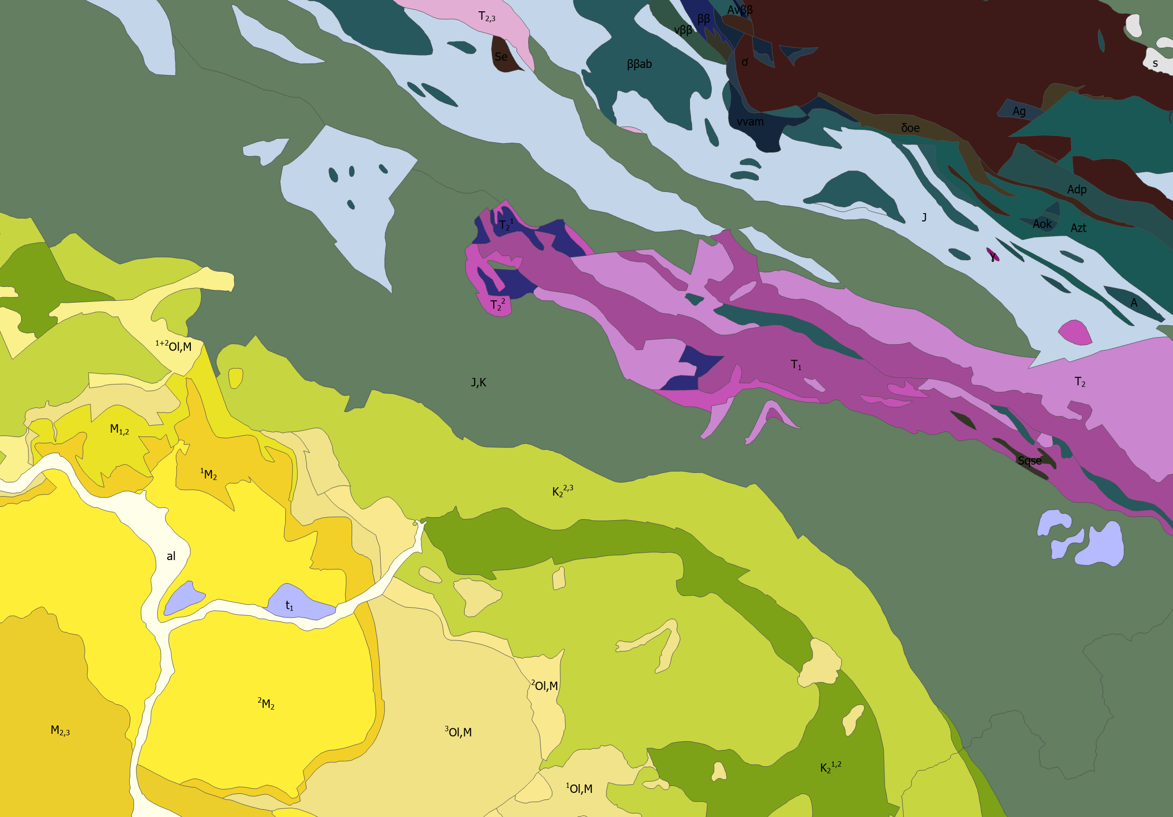
Lithostratigraphic units are vectorized polygon data derived from the Basic Geological Map of Bosnia and Herzegovina at a scale of 1:100.000 (BGM 1:100.000). The layer shows the spatial distribution and boundaries of lithostratigraphic units across the territory of Bosnia and Herzegovina, together with their basic geological characteristics and associated attribute data.
dataset
https://registri.ippfbih.gov.ba/registri_ipp/
Bosnian, Croatian, English, Serbian
Geoscientific information
GEMET - INSPIRE themes, version 1.0:
 Spatial scope:
EGDI Keyword Thesaurus:
European Geoscience Registry - Projects:
HVD category:
Spatial scope:
EGDI Keyword Thesaurus:
European Geoscience Registry - Projects:
HVD category:
Free:
lithostratigraphic units
geological structure
lithology
stratigraphy
BGM 1:100.000
15.729,
42.555,
19.624,
45.276
: 1961
1961
-
1990
completed
vector
The lithostratigraphic unit data are intended to provide a systematic representation of the spatial distribution and geological composition of the terrain, including lithological composition and stratigraphic relationships. They serve as a geological reference layer for spatial planning, natural resource management, mineral resource exploration, hydrogeological and engineering geological analyses, geohazard assessment, environmental protection, as well as scientific research and educational purposes.
Vedad Demir
Ustanička 11,
Ilidža, Sarajevo,
71210,
Bosna i Hercegovina
tel: +38733483365
email:
[email protected]
Role: custodian
Data Quality
The lithostratigraphic unit data were derived from the Basic Geological Map of Bosnia and Herzegovina (BGM) at a scale of 1:100.000. The preparation of the BGM began in 1961 and was officially completed in 1990. The map was produced within the Geological Survey based in Ilidža, with the participation of more than 150 geological engineers and geological technicians. The territory of Bosnia and Herzegovina was mapped using map sheets at a scale of 1:100.000. The vector data on lithostratigraphic units represent the digitization and spatial interpretation of the geological units shown on the BGM at a scale of 1:100.000.
Constraints
Use and access to data in accordance with the applicable regulations and practices of the Geological Survey of the Federation.
Vector data have restricted use and are issued upon request.
Metadata about metadata
6a9fede0-99fc-4bd6-99a1-360490a010e92
Maida Zejnic
Ustanička 11,
Ilidža, Sarajevo,
71210,
Bosna i Hercegovina
tel: +38733483368
email:
[email protected]
Role: point of contact
2026-09-08