Report on the Engineering-Geological Characteristics of the Terrain at the ‘Mladoševica’ Landslide Site in Maglaj


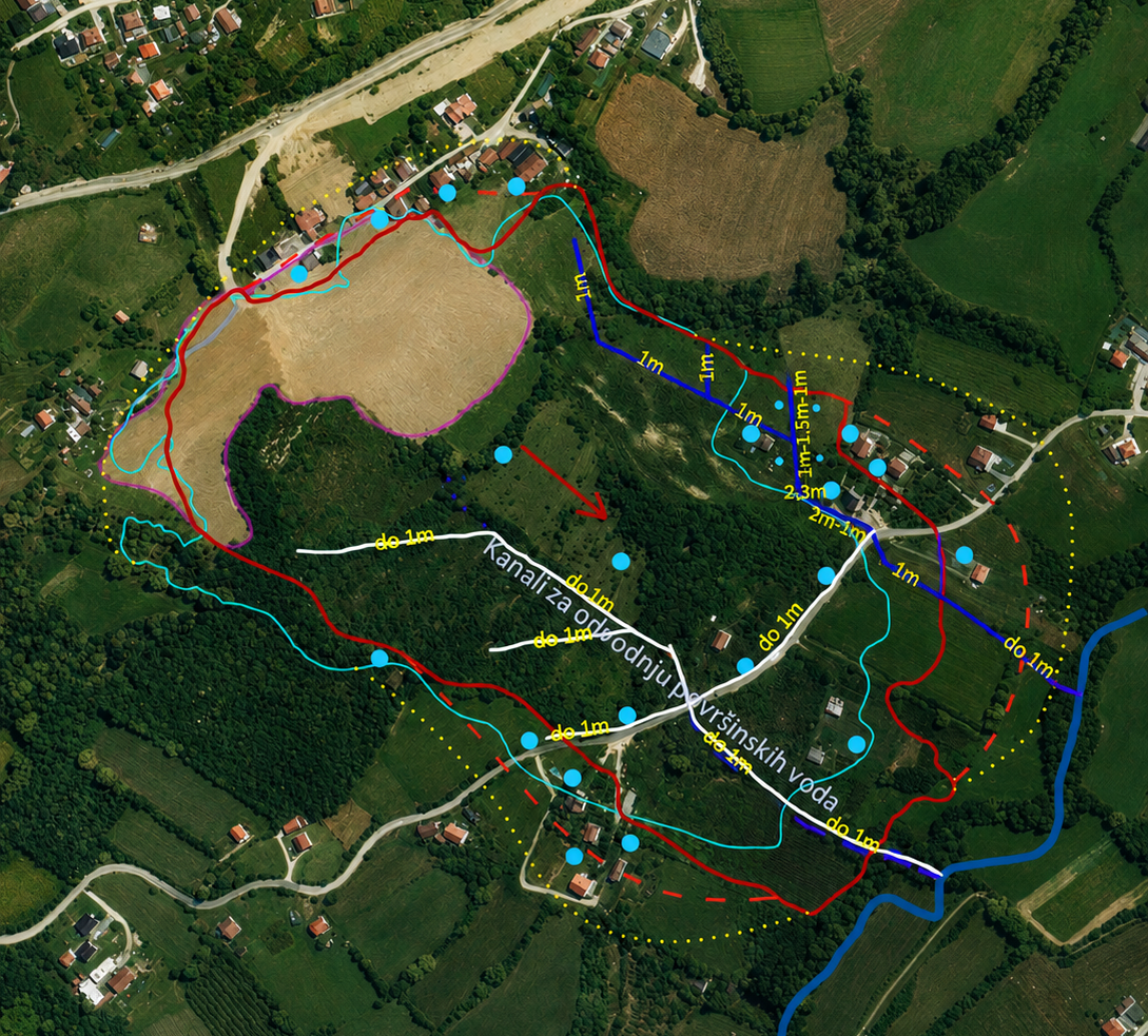
The report provides an overview of the engineering-geological characteristics and the current condition of the terrain at the “Mladoševica” landslide site in Maglaj. It includes data on the geological structure of the terrain, the characteristics and spatial extent of the landslide, the causes and conditions leading to its reactivation, as well as the conditions observed during field inspections conducted in January 2025.
The “Mladoševica” landslide is an old detrital landslide, documented and investigated in 2015, whose reactivation is associated with an increase in groundwater levels due to snowmelt and prolonged rainfall. The report also includes information on previously prepared design documentation for landslide remediation, as well as recommendations and guidelines for further action.
The “Mladoševica” landslide is an old detrital landslide, documented and investigated in 2015, whose reactivation is associated with an increase in groundwater levels due to snowmelt and prolonged rainfall. The report also includes information on previously prepared design documentation for landslide remediation, as well as recommendations and guidelines for further action.
dataset
Bosnian
Geoscientific information
GEMET - INSPIRE themes, version 1.0:

 Spatial scope:
EGDI Keyword Thesaurus:
European Geoscience Registry - Projects:
HVD category:
Spatial scope:
EGDI Keyword Thesaurus:
European Geoscience Registry - Projects:
HVD category:
Free:
geology
landslide
geohazards
15.729,
42.555,
19.624,
45.276
2025
completed
vector, text table, grid
The purpose of this report is to determine and document the engineering-geological characteristics and current condition of the terrain at the “Mladoševica” landslide site in Maglaj, to define the extent and characteristics of the landslide, and to provide professional guidance and recommendations for conducting further detailed investigations and preparing appropriate design documentation for the remediation and stabilization of the terrain.
Geological Survey of the FBiH
Vedad Demir
Ustanička 11,
Ilidža, Sarajevo,
71210,
Bosna i Hercegovina
tel: +38733483365
email:
[email protected]
Role: author
Emir Hodzic
Ustanička 11,
Ilidža, Sarajevo,
71210,
Bosna i Hercegovina
tel: +38733483375
email:
[email protected]
Role: author
Data Quality
The data are based on field engineering-geological investigations, reconnaissance surveys, GPS surveying, and aerial photogrammetric surveying of the terrain conducted by the Federal Institute for Geology (FZZG) at the “Mladoševica” landslide site in Maglaj in January 2025.
In processing the data, the available professional and technical documentation was used, including the Basic Geological Map, data from regional geological investigations of Central Bosnia, and documentation related to the engineering-geological investigations and the landslide remediation project carried out in 2015.
In processing the data, the available professional and technical documentation was used, including the Basic Geological Map, data from regional geological investigations of Central Bosnia, and documentation related to the engineering-geological investigations and the landslide remediation project carried out in 2015.
Equivalent Scale:
1:
1
Constraints
Use of and access to the data in accordance with the applicable regulations and practices of the Federal Institute for Geology.
Metadata about metadata
6a9ac07c-6ac8-4995-bc60-2f5580a010e92
Maida Zejnic
Ustanička 11,
Ilidža, Sarajevo,
71210,
Bosna i Hercegovina
tel: +38733483368
email:
[email protected]
Role: point of contact
2026-09-04