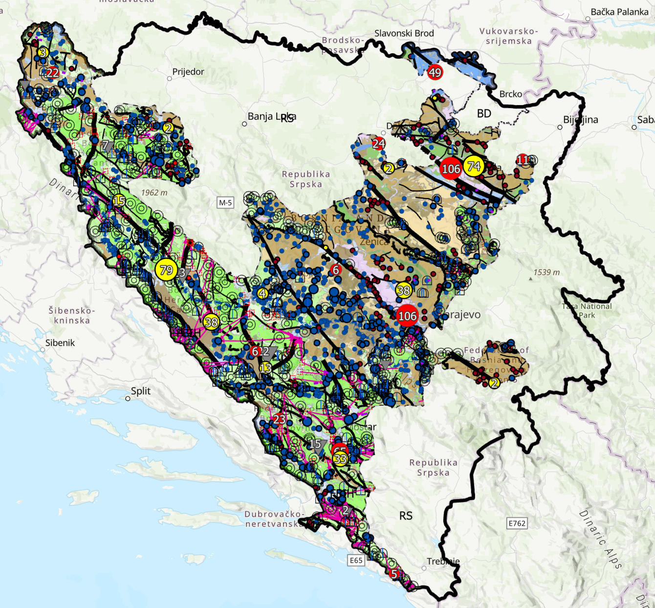
Hydrogeological Map of the Federation of Bosnia and Herzegovina (1:100.000)


The Hydrogeological Map of the Federation of Bosnia and Herzegovina at a scale of 1:100,000 presents the main hydrogeological characteristics of the territory of the Federation of Bosnia and Herzegovina. The map depicts hydrogeological units, their main hydrogeological characteristics, aquifer types, groundwater occurrences, and other relevant hydrogeological features. The data provide an overview of the spatial distribution of hydrogeological properties and serve as a basic reference for hydrogeological investigations, groundwater management and protection, spatial planning, and other activities related to water resource management.
dataset
Bosnian
Environment
Geoscientific information
Inland waters
Planning/Cadastre
Geoscientific information
Inland waters
Planning/Cadastre
GEMET - INSPIRE themes, version 1.0:

 Spatial scope:
EGDI Keyword Thesaurus:
European Geoscience Registry - Projects:
HVD category:
Spatial scope:
EGDI Keyword Thesaurus:
European Geoscience Registry - Projects:
HVD category:
Free:
hydrogeology
map
springs
underground waters
aquifers
15.729,
42.555,
19.624,
45.276
: 2024
2024
-
2025
under development
The purpose of the Hydrogeological Map of the Federation of Bosnia and Herzegovina at a scale of 1:100,000 is to provide a unified spatial representation of the main hydrogeological characteristics of the territory of the Federation of Bosnia and Herzegovina, including hydrogeological units, aquifers, and groundwater occurrences. The map is intended for hydrogeological investigations, groundwater management and protection, planning and utilization of water resources, spatial planning, as well as other professional, scientific, and development activities.
Geological Survey of the FBiH
Ferid Skopljak
Ustanička 11,
Ilidža, Sarajevo,
71210,
Bosna i Hercegovina
tel: +38733483367
email:
[email protected]
Role: author
Geological Survey of the FBiH
Cazim Saric
Ustanička 11,
Ilidža, Sarajevo,
71210,
Bosna i Hercegovina
tel: +38733483382
email:
[email protected]
Role: author
Data Quality
The data used for the preparation of the Hydrogeological Map of the Federation of Bosnia and Herzegovina at a scale of 1:100,000 were collected, processed, and harmonized based on available relevant hydrogeological documentation and data. The Basic Geological Map of Bosnia and Herzegovina at a scale of 1:100,000 was used as the primary geological and cartographic base, with relevant geological data utilized for hydrogeological interpretation and the preparation of the HGK 1:100,000. Data from relevant cadasters of groundwater resources for drinking water were also used, as well as data on occurrences and deposits of thermal, mineral, and thermomineral waters. The collected data were integrated, spatially analyzed, and interpreted to produce a unified hydrogeological representation of the territory of the Federation of Bosnia and Herzegovina.
Constraints
Use and access to data in accordance with the applicable regulations and practices of the Geological Survey of the Federation.
Vector data have restricted use and are issued upon request.
Metadata about metadata
6a9abe82-d308-4204-8762-2fc1a0a010e92
Maida Zejnic
Ustanička 11,
Ilidža, Sarajevo,
71210,
Bosna i Hercegovina
tel: +38733483368
email:
[email protected]
Role: point of contact
2026-09-07