Report on Geological and Hydrogeological Processes Following Floods and Landslides in the Federation of Bosnia and Herzegovina


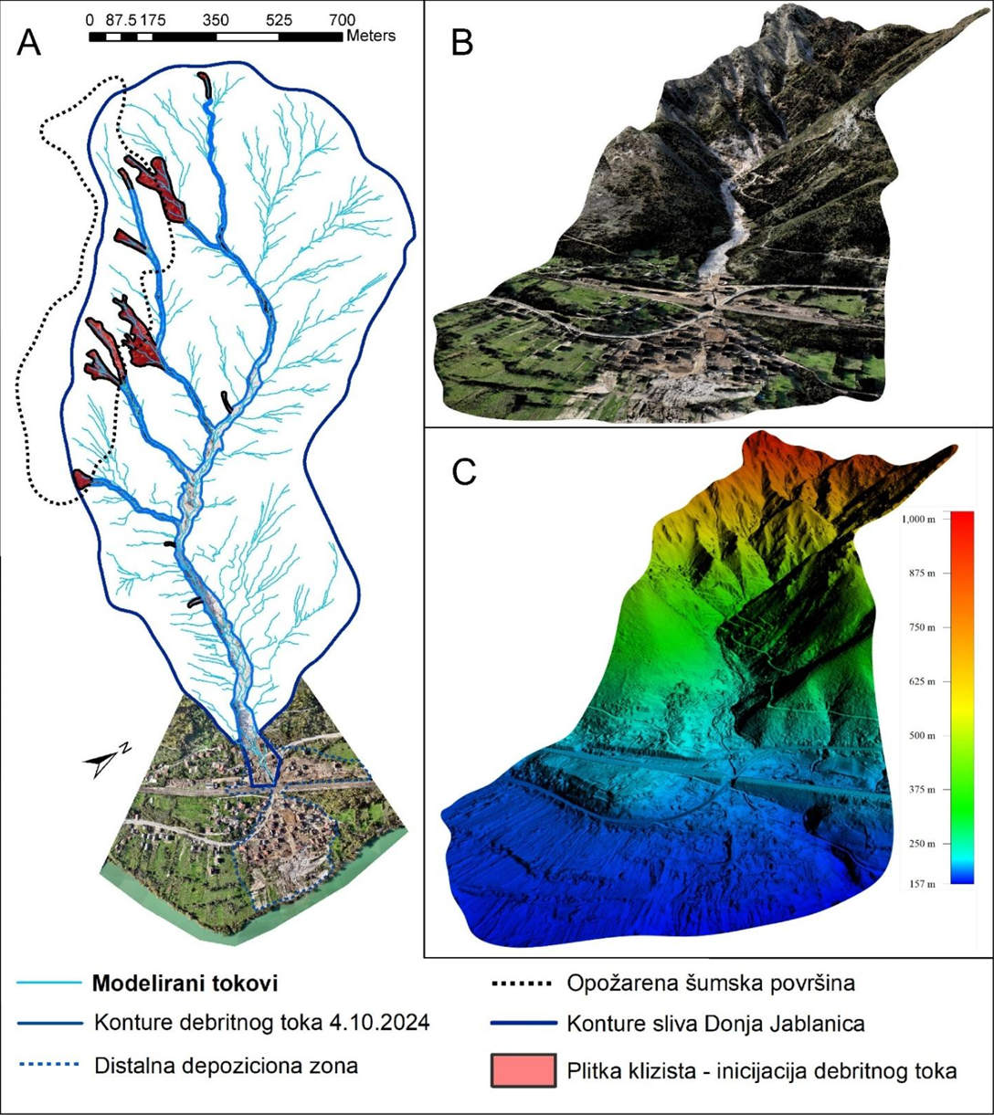
The report presents an integrated analysis of geological, hydrogeological, engineering-geological and geomorphological processes triggered by floods and landslides in the Federation of Bosnia and Herzegovina. It covers the areas of Jablanica, Konjic, Fojnica, Kiseljak and Kreševo, with particular focus on debris flows, landslides, erosion processes, terrain stability and the condition of drinking water springs. The report includes hazard and risk assessment, risk zoning, a landslide susceptibility map, the Basic Geological Map and Hydrogeological Map, as well as recommendations for risk reduction, spatial planning and future protection measures. A specific section addresses the assessment of settlement suitability in the Donja Jablanica area and the analysis of the planning and legal framework prior to the catastrophic event of October 2024.
dataset
Bosnian
Climatology/Meteorology/Atmosphere
Environment
Geoscientific information
Environment
Geoscientific information
GEMET - INSPIRE themes, version 1.0:


 Spatial scope:
EGDI Keyword Thesaurus:
European Geoscience Registry - Projects:
HVD category:
Spatial scope:
EGDI Keyword Thesaurus:
European Geoscience Registry - Projects:
HVD category:
Free:
report
geology
Jablanica
Konjic
Fojnica
Kreševo
geological hazard
debris flow
15.729,
42.555,
19.624,
45.276
: 2024
2024
-
2025
completed
vector, text table, grid
The data were collected and developed for the purpose of analysing the consequences of the natural disaster caused by floods and landslides in October 2024, based on the assigned tasks and the Conclusion of the Government of the Federation of Bosnia and Herzegovina. They are intended to support the assessment of geological, hydrogeological, engineering-geological and geomorphological hazards and risks, the evaluation of terrain conditions and stability, the identification of vulnerable areas, and the development of recommendations for risk reduction and the prevention of future events. The data provide a scientific and professional basis for spatial planning, the planning of protection and remediation measures, natural hazard management, and decision-making aimed at protecting the population, infrastructure and other vulnerable areas.
Vedad Demir
Ustanička 11,
Ilidža, Sarajevo,
71210,
Bosna i Hercegovina
tel: +38733483365
email:
[email protected]
Role: author
Data Quality
The data were collected and processed as part of field investigations conducted by the Federal Geological Survey following the floods and landslides in October 2024 in the affected areas of the Federation of Bosnia and Herzegovina. The data are the result of field-based geological, hydrogeological, engineering-geological and geomorphological investigations, as well as the analysis of existing geological and hydrogeological data, cartographic reference data, spatial analyses and modelling. The data were systematized and integrated within the report on negative engineering-geological phenomena and processes in the areas of Jablanica, Konjic, Fojnica, Kiseljak and Kreševo.
Equivalent Scale:
1:
2500
, 1:
100000
Constraints
Metadata about metadata
6a9aa925-7fa8-4505-88c7-2f5550a010e92
Maida Zejnic
Ustanička 11,
Ilidža, Sarajevo,
71210,
Bosna i Hercegovina
tel: +38733483368
email:
[email protected]
Role: point of contact
2026-09-04