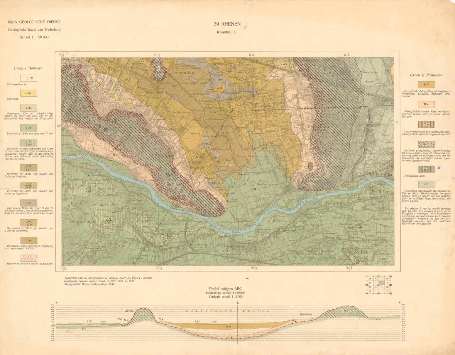
Geological map of the Netherlands (Tesch, 1918-1950)

Geological map series on 1:50.000 by the Rijks Geologische Dienst. The geological information for most sheets was collected and surveyed by Pieter Tesch. The sheets were published between 1925 and 1952.
series
Geologische Dienst Nederland
- Website with visualisations, information and downloads
6984abb2-53d0-4a14-97dc-40840a010e58
Dutch
Geoscientific information
GEMET - INSPIRE themes, version 1.0:
 Spatial scope:
EGDI Keyword Thesaurus:
HVD category:
Spatial scope:
EGDI Keyword Thesaurus:
HVD category:
2.793,
50.591,
7.395,
53.972
publication: 1952-01-01
1952-01-01
completed
vector
Project leader
Princetonlaan 6,
Utrecht,
3584 CB,
Netherlands
tel: 0888664300
email:
[email protected]
Role: custodian
Data Quality
The geological information for most sheets was collected and surveyed by Pieter Tesch.
Equivalent Scale:
1:
50000
Constraints
Metadata about metadata
6984abb2-53d0-4a14-97dc-40840a010e58
Reinder Reindersma
Princetonlaan 6,
Utrecht,
3584 CB,
Netherlands
tel: 0888664300
email:
[email protected]
Role: point of contact
2026-06-17