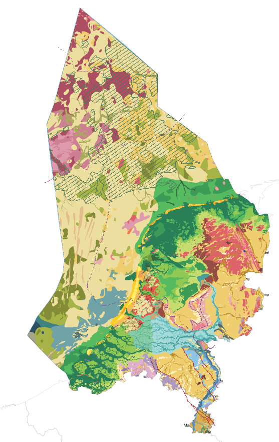
Geological map of the Kingdom of the Netherlands

The map shows the geological deposits at the surface, or until a depth of 5m of the Kingdom of the Netherlands. It includes the Netherlands, the Dutch part of the North Sea and the Dutch Carribean (Aruba, Bonaire, Curaçao, Sint Maarten, Sint Eustatius and Saba)
dataset
DINOloket
- Website with visualisations, information and downloads
https://www.nationaalgeoregister.nl/geonetwork/srv/dut/catalog.search#/metadata/80630ee7-3a15-4ea0-bdc0-a8aebfa2f204
Dutch
Geoscientific information
GEMET - INSPIRE themes, version 1.0:
 Spatial scope:
EGDI Keyword Thesaurus:
European Geoscience Registry - Projects:
HVD category:
HVD category:
HVD category:
HVD category:
HVD category:
HVD category:
HVD category:
Spatial scope:
EGDI Keyword Thesaurus:
European Geoscience Registry - Projects:
HVD category:
HVD category:
HVD category:
HVD category:
HVD category:
HVD category:
HVD category:
1.354,
50.424,
7.682,
56.728
publication: 2022-01-24
2022-01-24
completed
vector
Project leader
Princetonlaan 6,
Utrecht,
3584 CB,
Netherlands
tel: 0888664300
email:
[email protected]
Role: custodian
Data Quality
The map is mainly based on the results of the Dutch national geological 3D models DGM, REGIS II and GeoTOP
Equivalent Scale:
1:
600000
Constraints
Metadata about metadata
69847d96-92f0-4068-b2fd-32cd0a010e58
Reinder Reindersma
Princetonlaan 6,
Utrecht,
3584 CB,
Netherlands
tel: 0888664300
email:
[email protected]
Role: point of contact
2026-05-27