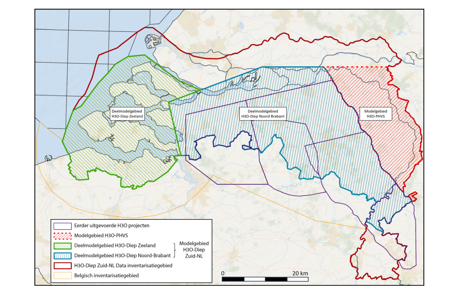
H3O-Deep South-Netherlands

Geological layer model of the shallow and deep subsurface of North-Brabant en Zeeland.
dataset
https://www.dinoloket.nl/downloads-h3o-diep-zuid-nederland
Dutch
Geoscientific information


2.871,
50.943,
6.219,
52.15
creation: 2024-12-20
2024-12-20
min: -8800
max: 300
CRS: Local - depth (http://www.opengis.net/def/crs/EPSG/0/1049)
completed
grid
The model is a regional version of the DGM deep model and is mainly created for groundwater purposes and to intergrate with the shallow subsurface models.
Project leader
Princetonlaan 6,
Utrecht,
3584 CB,
Netherlands
tel: 0888664300
email:
[email protected]
Role: custodian
Data Quality
The geological model for the southern part of the Netherlands is mainly based on seismic data and is modelled in Petrel.
Minimal Distance:
250 m
Constraints
Metadata about metadata
698473ab-edd4-4022-9b8d-2f240a010e58
Reinder Reindersma
Princetonlaan 6,
Utrecht,
3584 CB,
Netherlands
tel: 0888664300
email:
[email protected]
Role: point of contact
2026-06-17