NL3D

Low-resolution (250m) voxel model of the upper part of the subsurface of the Netherlands down to of the to 50 meters below sea level.
dataset
https://www.dinoloket.nl/nl3d-voxelmodel-van-de-ondiepe-ondergrond-van-nederland
Dutch
Geoscientific information


3.358,
50.751,
7.227,
53.554
publication: 2024-10-22
2024-10-22
min: -50
max: 322
CRS: Local - depth (http://www.opengis.net/def/crs/EPSG/0/1049)
onGoing
grid
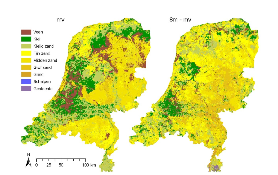
The model is created as a lower resolution version of GeoTOP that is not yet availible nationwide.
Project leader
Princetonlaan 6,
Utrecht,
3584 CB,
Netherlands
tel: 0888664300
email:
[email protected]
Role: custodian
Data Quality
The multi-purpose voxel model is based on the BRO DGM model. It is a lower resolution version of the GeoTOP model, that is not yet nationwide available.
Minimal Distance:
0.5 m
Constraints
Metadata about metadata
69846ed6-b078-40a8-8a24-2e010a010e58
Reinder Reindersma
Princetonlaan 6,
Utrecht,
3584 CB,
Netherlands
tel: 0888664300
email:
[email protected]
Role: point of contact
2026-05-27