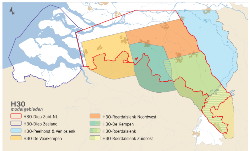
H3O-De Voorkempen

Cross-border hydrogeological layer model of the Voorkempen region in the Netherlands and Belgium.
dataset
https://www.dinoloket.nl/downloads-h3o-de-voorkempen
Dutch
Geoscientific information
GEMET - INSPIRE themes, version 1.0:
 Spatial scope:
EGDI Keyword Thesaurus:
European Geoscience Registry - Projects:
Spatial scope:
EGDI Keyword Thesaurus:
European Geoscience Registry - Projects:
Free:
cross-border
4.229,
51.262,
4.977,
51.694
publication: 2023-09-28
2023-09-28
min: -1100
max: 35
CRS: Local - depth (http://www.opengis.net/def/crs/EPSG/0/1049)
completed
grid
The model is a regional version of the BRO REGIS II model and is mainly created for groundwater purposes and to integrate with Belgium models.
Project leader
Princetonlaan 6,
Utrecht,
3584 CB,
Netherlands
tel: 0888664300
email:
[email protected]
Role: custodian
Data Quality
The cross-border hydrogeological model of the Voorkempen area in Belgium and the Netherlands is mainly based on manually interpreted boreholes and modelled in Isatis.
Minimal Distance:
100 m
Constraints
Metadata about metadata
698461eb-6140-4242-a347-25fc0a010e58
Reinder Reindersma
Princetonlaan 6,
Utrecht,
3584 CB,
Netherlands
tel: 0888664300
email:
[email protected]
Role: point of contact
2026-05-27