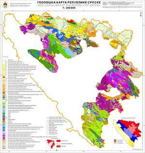
Geological Map of the Republic of Srpska
The Geological map of the Republic of Srpska (1:300.000) is the first clear map of Srpska that shows geological structure and the history of the terrain creation from the Paleozoic to the Quaternary, covering the period of more than 600 million years. Knowledge of geological structures is particularly important for every state, because it conditions the richness or poverty in terms of mineral resources. A type and kind of rocks are prerequisites for the creation of drinking water reserves, and bedrocks, together with climatic factors, condition the soil type important for food production. The relief is also conditioned by a geological structure and enables the utilization of water energy for electricity production.

dataset
https://data.rzzgi.bh/id/GEOL300
English, Serbian
Geoscientific information
GEMET - INSPIRE themes, version 1.0:
Spatial scope:
GeoERA Keyword Thesaurus:
Free:
geological maps
16.194,
42.539,
19.666,
45.293
publication: 2014
1960
-
2014
vector
Long-Term Program for Development of Basic Geological Explorations of the Republic of Srpska.
Geological Survey of the Republic of Srpska (RZZGI)
Dražan Tokanović
Vuka Karadzica 148 B, Zvornik,
75400,
Bosnia and Herzegovina
tel: +387 56 210 413
email:
[email protected]
Role: custodian
Data Quality
The Basic Geological Map of the SFRY 1:100 000 was completed in the 1980s and published in the form of multiple sheets. The Geological Map of the Republic of Srpska 1:300 000 was produced in accordance with the Long-Term Program for the Development of Basic Geological Research of the Republic of Srpska due to the need for creating a unified geological map of the Republic of Srpska. This map was largely compiled from the geology of the aforementioned Basic Geological Map of the SFRY.
Equivalent Scale:
1:
300000
Constraints
Metadata about metadata
6613edd4-373c-4eed-9764-30a40a010855
Geological Survey of the Republic of Srpska (RZZGI)
Dražan Tokanović
Vuka Karadzica 148 B, Zvornik,
75400,
Bosnia and Herzegovina
tel: +387 56 210 413
email:
[email protected]
Role: point of contact
2025-03-13


