H3O-PLUS

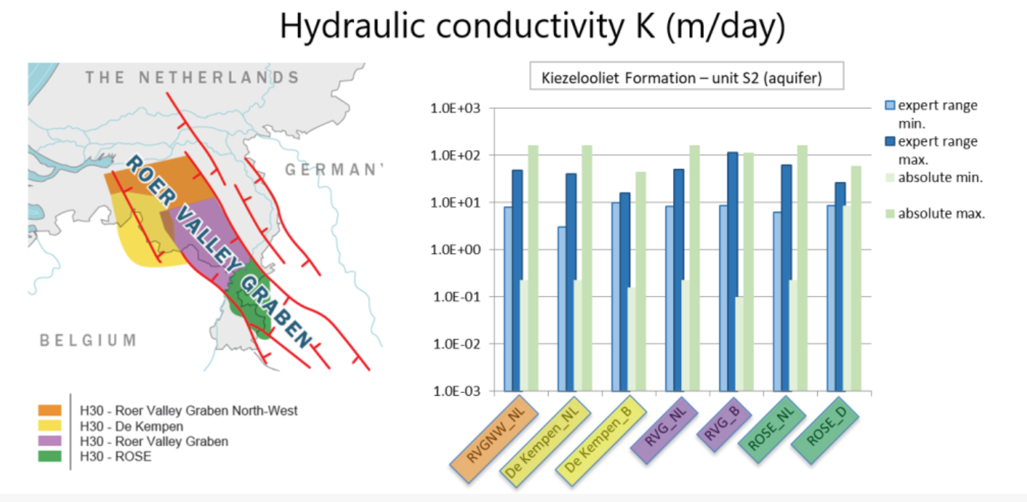
The cross-border model H3O-PLUS builds on 3D geometries developed in previous H3O-projects and aims at developing harmonized hydrogeological information for the Roer Valley Graben in the Netherlands, Germany and Belgium
dataset
GeoERA - RESOURCE
- Website with 3D model visualisations and downloads
https://geoera.eu/projects/resource9/
English
Geoscientific information
GEMET - INSPIRE themes, version 1.0:

 Spatial scope:
INSPIRE priority data set:
EGDI Keyword Thesaurus:
European Geoscience Registry - Projects:
Spatial scope:
INSPIRE priority data set:
EGDI Keyword Thesaurus:
European Geoscience Registry - Projects:
4.755,
50.793,
6.161,
51.741
creation: 2021-06-07
2021-06-07
min: -1500
max: 200
CRS: Local - depth (http://www.opengis.net/def/crs/EPSG/0/1049)
vector
Project leader
Princetonlaan 6,
Utrecht,
3584 CB,
Netherlands
tel: +31646966183
email:
[email protected]
Role: custodian
Data Quality
Dataset of the combined results of the H3O-projects by the Geological Surveys of the Netherlands, Flanders and Nordrhein-Westphalia
Minimal Distance:
100 m
Constraints
Metadata about metadata
60be0a67-b9e4-4fa7-941b-7d360a010833
Princetonlaan 6,
Utrecht,
3584 CB,
Netherlands
tel: 0888664300
email:
[email protected]
Role: point of contact
2026-05-27