BGS Geology 250k Bedrock version 4

Data identifying landscape areas (shown as polygons) attributed with geological names and rock type descriptions. The scale of the data is 1:250 00, providing a generalised geology. Onshore coverage is provided for all of England, Wales, Scotland and the Isle of Man. Bedrock geology describes the main mass of solid rocks forming the Earth's crust. Bedrock is present everywhere, whether exposed at surface in outcrops or concealed beneath superficial deposits or water bodies. The bedrock geology of Great Britain is very diverse and includes three broad classes based on their mode of origin: igneous, metamorphic and sedimentary. The data includes attribution to identify each rock type (in varying levels of detail) as described in the BGS Rock Classification Scheme (RCS) (volumes 1-3). The bedrock has formed over long periods of geological time, from the Archean Eon, some 3500 million years ago, to the relatively young Pliocene, 58 million years ago. The age of the rocks is identified in the data through their name in the BGS Lexicon of Named Rock Units (published for each deposit at the time of the original survey or subsequent digital data creation). For stratified rocks, i.e. those arranged in sequence, this will usually be of a lithostratigraphic type. Other rock types (for example, intrusive igneous bodies) will be of a lithodemic type. More information on the formal naming of UK rocks is available in the BGS Lexicon of Named Rock Units. Geological names are based on the lithostratigraphic or lithodemic hierarchy. The lithostratigraphic scheme arranges rock bodies into units based on rock type and geological time of formation. Where rock types do not fit into the lithostratigraphic scheme, for example intrusive rocks or deformed rocks subjected to heat and pressure, resulting in new or changed rock types; then their classification is based on their rock-type or lithological composition, using visible features such as texture, structure, mineralogy. The data are available in vector format (containing the geometry of each feature linked to a database record describing their attributes) as ESRI Shapefiles and are available under BGS data licence.
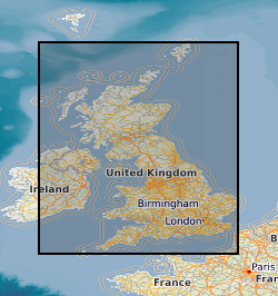
dataset
Citation Information - Digital Object Identifier (DOI)
- Digital Geological Map Data of Great Britain - 250k (DiGMapGB-250) Bedrock version 4 British Geological Survey 2005
BGS Geology: onshore digital geological map of Great Britain data
- The BGS Geology datasets are digital geological maps of Great Britain based on the different series of published BGS geological maps.
:
http://data.bgs.ac.uk/id/dataHolding/13606375
English
Geoscientific information
GEMET - INSPIRE themes, version 1.0:
 BGS Thesaurus of Geosciences:
Bed rock
GIS
Digital maps
Geology
Data
Maps
Free:
NERC_DDC
-8.65,
49.77,
1.78,
60.86
GBN, GREAT BRITAIN [id=139600]
creation: 2005
unknown
-
> 2005
vector
British Geological Survey (BGS)
Enquiries
Environmental Science Centre, Nicker Hill, Keyworth,
NOTTINGHAM,
NG12 5GG,
United Kingdom
tel: 0115 936 3143
email:
[email protected]
Role: distributor
British Geological Survey (BGS)
Enquiries
Environmental Science Centre, Nicker Hill, Keyworth,
NOTTINGHAM,
NG12 5GG,
United Kingdom
tel: 0115 936 3143
email:
[email protected]
Role: point of contact
Data Quality
Each 100 x 100 km digital tile is based on the latest BGS 1:250 000 scale UTM (Universal Transverse Mercator projection) bedrock or ‘solid’ geological map. This series was originally published between 1977 and 1993. Most of the onshore areas were compiled in the 1980s and are based, primarily, on earlier more detailed 1:50 000 (and one-inch to one-mile) geological maps published in the preceding decades and dating from the 1870s through to the 1980s. The source 1:250 000 published maps have a chronostratigraphical classification but were reclassified, as far as possible, with a lithostratigraphical nomenclature for the digital data. Some changes were made to the published lines to correct errors, improve the fit between maps, add formational boundaries or remove purely chronostratigraphical ones. The sources of information specific to each digital tile are available. The generalised geological lines were fitted to topographical bases compiled from Ordnance Survey 1:250 000 maps and Ministry of Defence, Joint Operations Graphic (JOG) sheets. The UTM series sheets were scanned and re-projected to OS British National Grid for digitising. For version 4 (release 2005), the digital data were re-tiled into 100 km squares and re-fitted to the OS Strategi coastline, and RCS (BGS Rock Classificiation Scheme) codes were added.
Equivalent Scale:
1:
250000
INSPIRE Implementing rules laying down technical arrangements for the interoperability and harmonisation of Geology
Commission Regulation (EU) No 1089/2010 of 23 November 2010 implementing Directive 2007/2/EC of the European Parliament and of the Council as regards interoperability of spatial data sets and services
Constraints
The copyright of materials derived from the British Geological Survey's work is vested in the Natural Environment Research Council [NERC]. No part of this work may be reproduced or transmitted in any form or by any means, or stored in a retrieval system of any nature, without the prior permission of the copyright holder, via the BGS Intellectual Property Rights Manager. Use by customers of information provided by the BGS, is at the customer's own risk. In view of the disparate sources of information at BGS's disposal, including such material donated to BGS, that BGS accepts in good faith as being accurate, the Natural Environment Research Council (NERC) gives no warranty, expressed or implied, as to the quality or accuracy of the information supplied, or to the information's suitability for any use. NERC/BGS accepts no liability whatever in respect of loss, damage, injury or other occurence however caused.
The dataset is made available to external clients under BGS Digital Data Licence terms and conditions. Revert to the IPR Section ([email protected]) if further advice is required with regard to permitted usage.
The dataset is made freely available for access, e.g. via the Internet. Either no third party data / information is contained in the dataset or BGS has secured written permission from the owner(s) of any third party data / information contained in the dataset to make the dataset freely accessible.
Metadata about metadata
0600d0f5-2bca-5428-e054-002128a47908
British Geological Survey (BGS)
Environmental Science Centre,Keyworth,
NOTTINGHAM,
NG12 5GG,
United Kingdom
tel: +44 115 936 3100
email:
[email protected]
Role: point of contact
2026-09-09