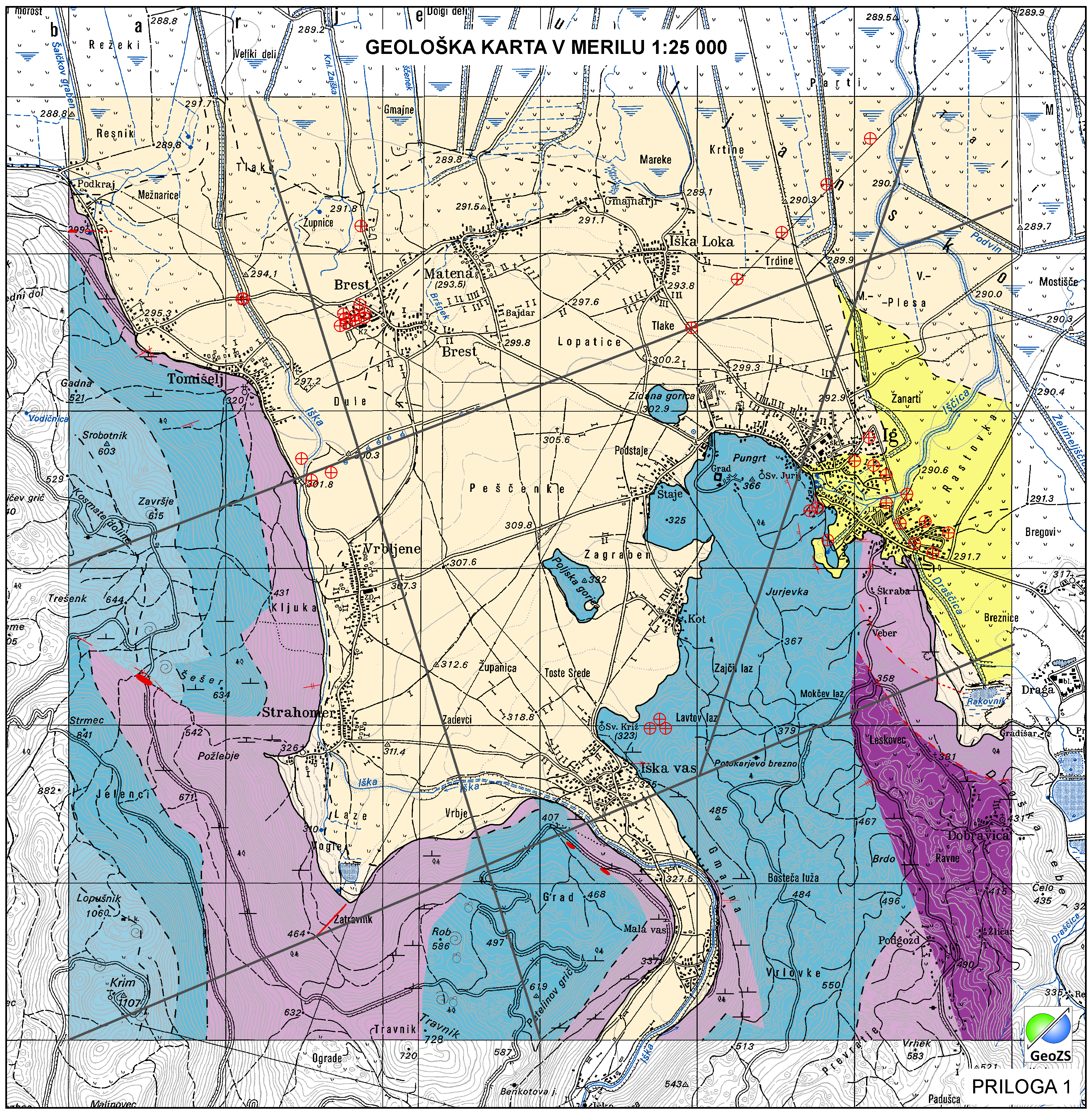
Hydrogeological map of Iška alluvial fan 1:25 000 ATOM services


Data of Geological map were reclassified into classes of IAH classification on the base of hydrogeological characteristics. IAH classification is based on description of the hydrogeological units. Firstly, based on extensiveness and productivity and secondly on type of porosity.
The purpose is to provide assistance to the strategy of groundwater exploitation as to protection and water resources management.
The purpose is to provide assistance to the strategy of groundwater exploitation as to protection and water resources management.
large_thumbnail
service
- infoFeatureAccessService
download
GEMET - INSPIRE themes, version 1.0:
ISO - 19119 geographic services taxonomy:
Spatial scope:
Geology
infoFeatureAccessService
Local
Free:
ATOM
Free:
Slovenia
Free:
geology
hydrogeology
Free:
INSPIRE
EGDI
Free:
regionalna geologija
14.466,
45.924,
14.544,
45.981
creation: 2021-10-10, publication: 2021-10-10, revision: 2021-10-10
The main objective of the map is the identification and characterization of groundwater bodies on the national scale (level). Also offers support for groundwater resources management and protection.
Geološki zavod Slovenije
?
Dimičeva ulica 14,
Ljubljana,
1000,
Slovenija
tel: +386 1 280 97 00
email:
[email protected]
Role: owner
Geološki zavod Slovenije
Matija Krivic
Dimičeva ulica 14,
Ljubljana,
1000,
Slovenija
tel: +386 1 28 09 700
email:
[email protected]
Role: point of contact
Geološki zavod Slovenije
?
Dimičeva ulica 14,
Ljubljana,
1000,
Slovenija
tel: +386 1 280 97 00
email:
[email protected]
Role: custodian
Data Quality
COMMISSION REGULATION (EC) No 976/2009 of 19 October 2009 implementing Directive 2007/2/EC of the European Parliament and of the Council as regards the Network Services
Constraints
Hidrogeološka karta Iškega vršaja v merilu 1:25000. Hidrogeološka karta še ni v uporabi "OSNUTEK"
Data is available under a Creative Commons - Attribution 4.0 International (CC BY 4.0) license. (https://creativecommons.org/licenses/by/4.0)
Metadata about metadata
b044eb4f-b75f-4122-9586-e736e8047f24
Geološki zavod Slovenije
Matija Krivic
Dimičeva ulica 14,
Ljubljana,
1000,
Slovenija
tel: +386 1 28 09 700
email:
[email protected]
Role: point of contact
2022-01-04