Bedding dip elements (BGM 1:100.000)


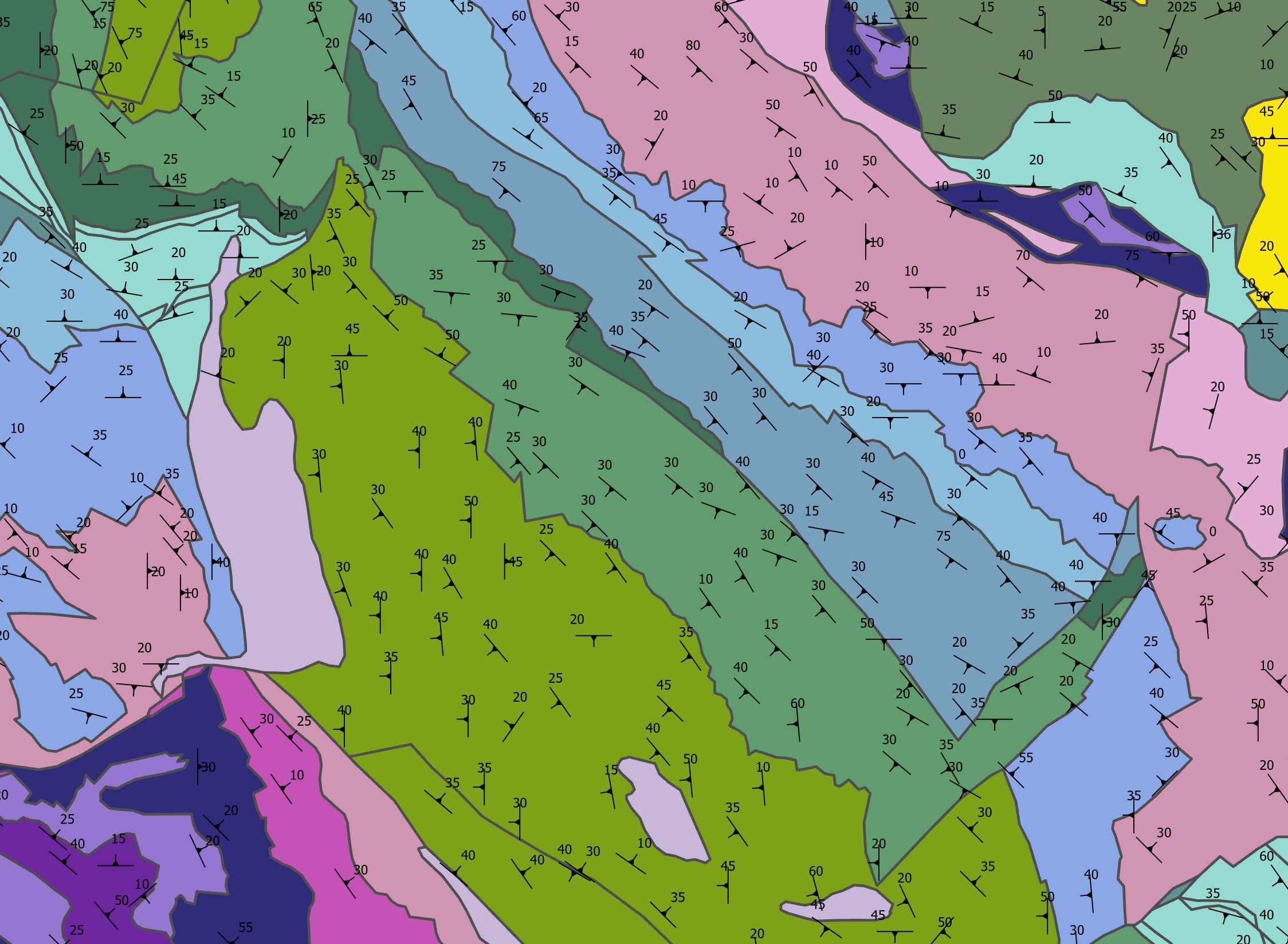
The dataset contains bedding dip elements derived from the Basic Geological Map of Bosnia and Herzegovina at a scale of 1:100,000 (BGM). The data represent the spatial location and orientation of geological strata, including the strike direction and dip angle of the layers. The bedding dip elements form an integral part of the geological documentation of the BGM and are used for the interpretation of the geological structure and structural relationships of the terrain, as well as for geological and other professional analyses.
dataset
https://registri.ippfbih.gov.ba/registri_ipp/
Bosnian, Croatian, English, Serbian
Geoscientific information
GEMET - INSPIRE themes, version 1.0:
 Spatial scope:
EGDI Keyword Thesaurus:
European Geoscience Registry - Projects:
HVD category:
Spatial scope:
EGDI Keyword Thesaurus:
European Geoscience Registry - Projects:
HVD category:
Free:
Bedding dip elements
strike
dip
dip angle
bedding orientation
structural geology
BGM
fzzg
15.729,
42.555,
19.624,
45.276
: 1961
1961-01-01
-
1990-01-01
vector
Bedding dip elements are used to represent the spatial orientation of geological strata, including their strike direction and dip angle. The data provide a professional basis for interpreting the geological structure and structural relationships of the terrain, producing and interpreting geological maps and profiles, as well as for geological, hydrogeological, and engineering geological analyses, spatial planning, and scientific research and educational purposes.
Vedad Demir
Ustanička 11,
Ilidža, Sarajevo,
71210,
Bosna i Hercegovina
tel: +38733483365
email:
[email protected]
Role: custodian
Data Quality
The data on bedding dip elements were derived from the Basic Geological Map of Bosnia and Herzegovina at a scale of 1:100,000 (BGM). The bedding dip elements form an integral part of the geological documentation of the BGM and were extracted and digitized from the original cartographic documentation. The data are the result of geological mapping and investigations carried out during the preparation of the Basic Geological Map of Bosnia and Herzegovina, the production of which began in 1961 and was completed in the early 1990s.
Constraints
Use and access to data in accordance with the applicable regulations and practices of the Geological Survey of the Federation.
Vector data have restricted use and are issued upon request.
Metadata about metadata
6a98160c-d7d8-4c9a-9471-2c5bd0a010e92
Maida Zejnic
Ustanička 11,
Ilidža, Sarajevo,
71210,
Bosna i Hercegovina
tel: +38733483368
email:
[email protected]
Role: point of contact
2026-09-29