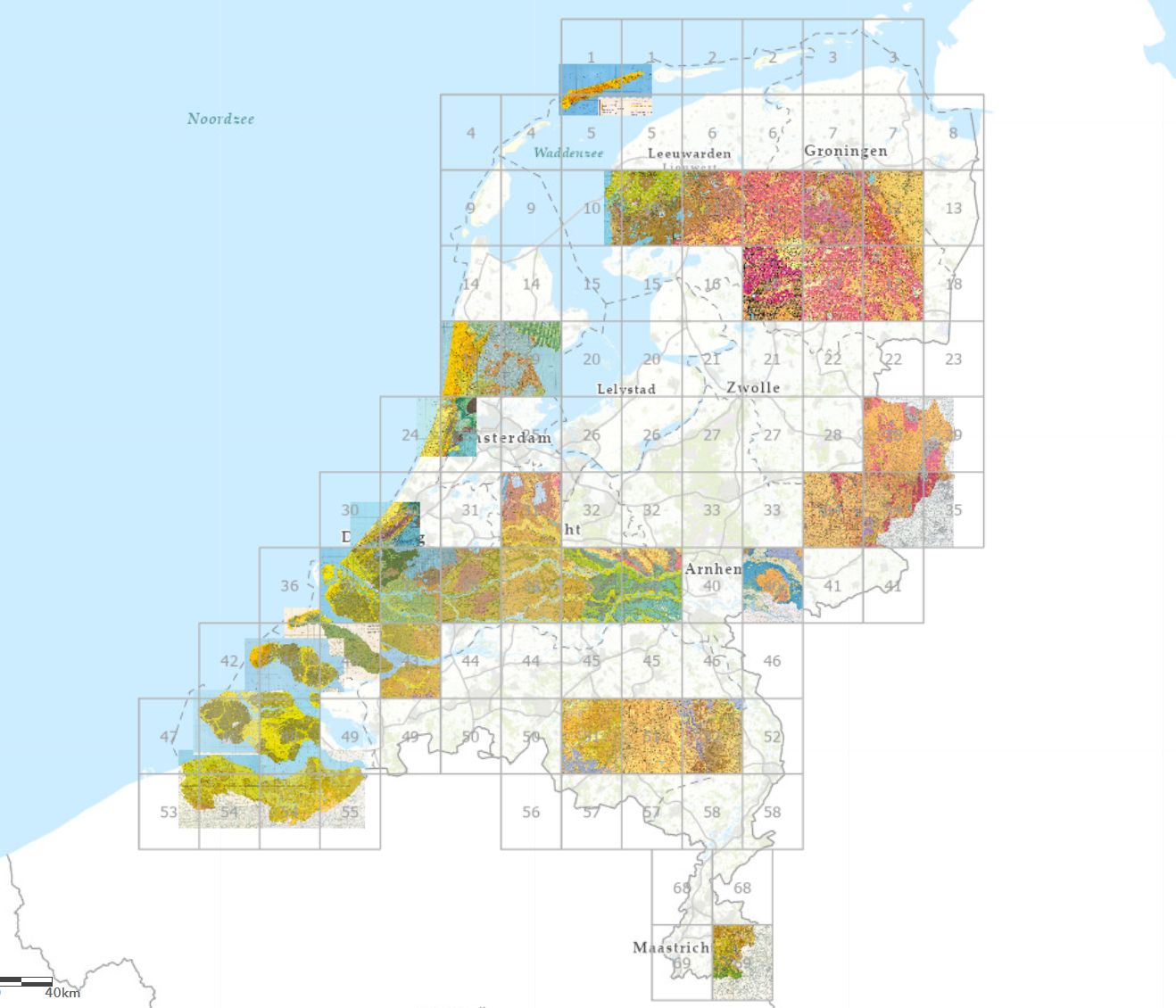
Geological map of the Netherlands (RGD, 1950-2000)

Geological map series on 1:50.000 by the Rijks Geologische Dienst. The sheets were published between 1950 and 2000.
series
Geologische Dienst Nederland
- Website with visualisations, information and downloads
https://metadata.europe-geology.eu/
Dutch
Geoscientific information
GEMET - INSPIRE themes, version 1.0:
 Spatial scope:
EGDI Keyword Thesaurus:
HVD category:
Spatial scope:
EGDI Keyword Thesaurus:
HVD category:
3.016,
50.531,
7.491,
53.84
publication: 2000-01-01
1950-01-01
-
2000-01-01
completed
vector
Project leader
Princetonlaan 6,
Utrecht,
3584 CB,
Netherlands
tel: 0888664300
email:
[email protected]
Role: custodian
Data Quality
Constraints
Metadata about metadata
6984ad1c-bbf0-4522-83b6-41380a010e58
Reinder Reindersma
Princetonlaan 6,
Utrecht,
3584 CB,
Netherlands
tel: 0888664300
email:
[email protected]
Role: point of contact
2026-06-17