ThermoGIS V2.5

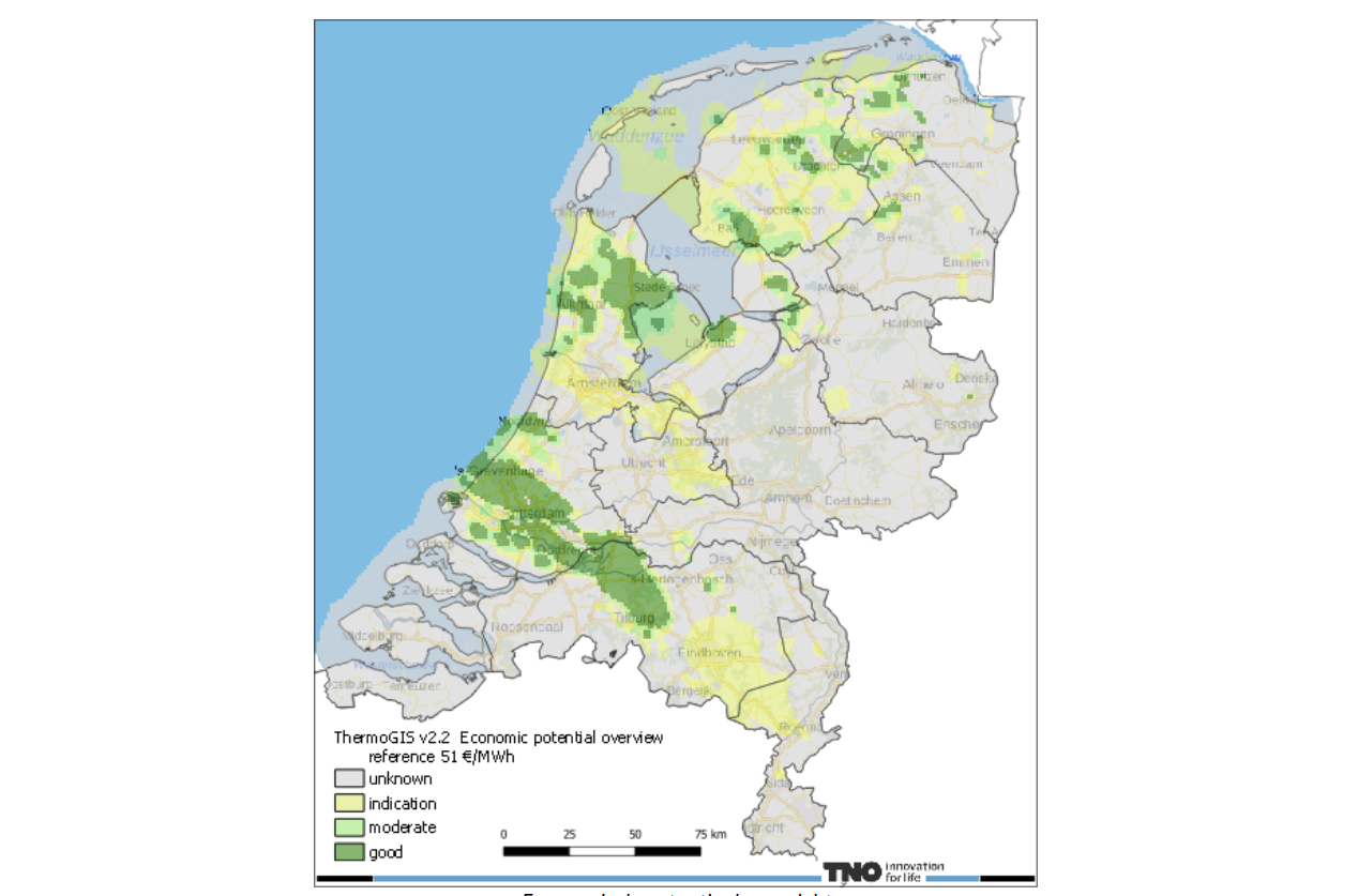
ThermoGIS is a public, web-based geographic information system that shows the regional potential of geothermal energy in the Netherlands based on a number of subsurface maps. It displays maps of the depth, thickness, permeability, and temperature of rock layers from which geothermal energy can potentially be extracted. The potential maps show, among other things, the achievable flow rate, as well as the temperature of the produced water or the geothermal power.
dataset
ThermoGIS
- Website with information and downloads
https://www.nationaalgeoregister.nl/geonetwork/srv/dut/catalog.search#/metadata/a71d154e-1027-4995-826f-e08fbce9a74a
Dutch
Geoscientific information
GEMET - INSPIRE themes, version 1.0:

 Spatial scope:
EGDI Keyword Thesaurus:
European Geoscience Registry - Projects:
Spatial scope:
EGDI Keyword Thesaurus:
European Geoscience Registry - Projects:
3.358,
50.751,
7.227,
53.554
publication: 2025-08-01
2025-08-01
min: -5000
max: 300
CRS: Local - depth (http://www.opengis.net/def/crs/EPSG/0/1049)
onGoing
grid
The model is created fot geothermal purposes.
Project leader
Princetonlaan 6,
Utrecht,
3584 CB,
Netherlands
tel: 0888664300
email:
[email protected]
Role: custodian
Data Quality
The geothermal model is mainly based on seismic data and is modelled in Petrel.
Minimal Distance:
250 m
Constraints
Metadata about metadata
698475ab-61f4-4a3a-9375-304b0a010e58
Reinder Reindersma
Princetonlaan 6,
Utrecht,
3584 CB,
Netherlands
tel: 0888664300
email:
[email protected]
Role: point of contact
2026-05-27