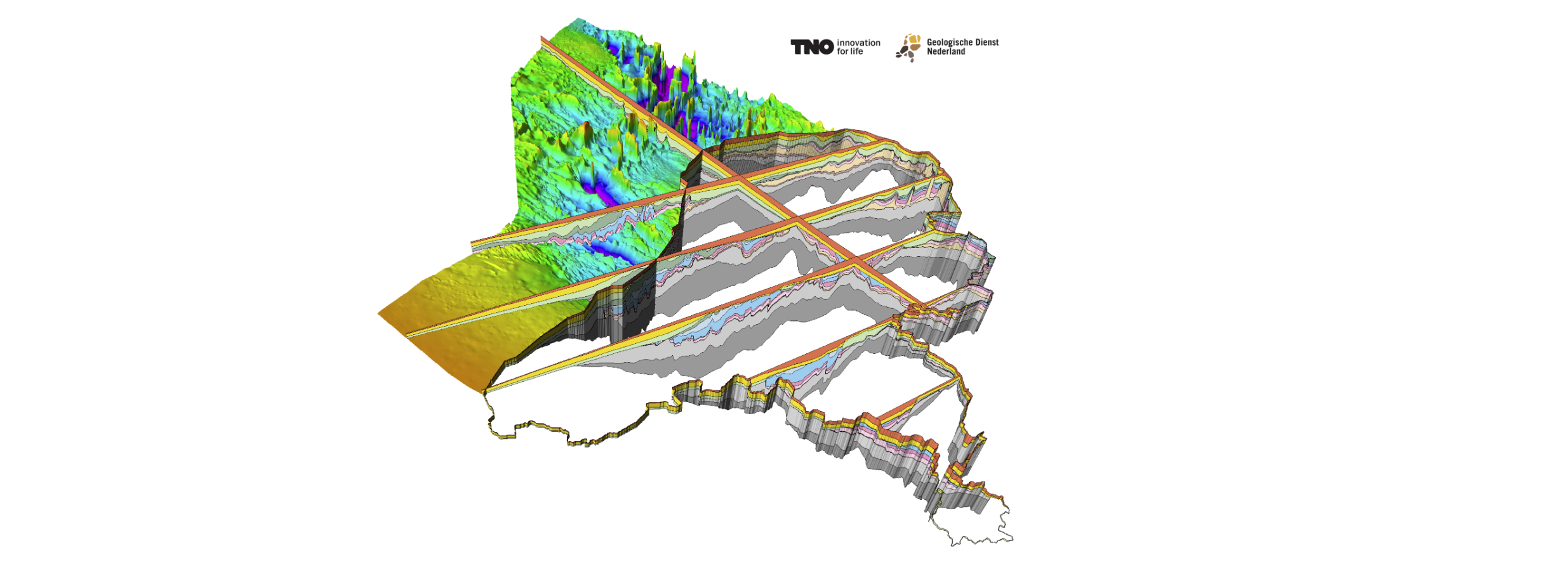
DGM-deep v5.0

Geological on-shore and off-shore layer model of the deep subsurface of the Netherlands.
dataset
https://www.nationaalgeoregister.nl/geonetwork/srv/dut/catalog.search#/metadata/E7D9F0D6-2B8D-6699-F26E-4A781228F2DD
Dutch
Geoscientific information


2.057,
50.789,
7.267,
56.181
publication: 2022-04-14
2022-04-14
min: -10000
max: 322
CRS: Local - depth (http://www.opengis.net/def/crs/EPSG/0/1049)
completed
grid
The model is mainly created to give a general overview of the deeper Dutch subsurface and as a framework model for more complex models
Project leader
Princetonlaan 6,
Utrecht,
3584 CB,
Netherlands
tel: 0888664300
email:
[email protected]
Role: owner
Data Quality
The geological model for the deep subsurface is mainly based on seismic data and is modelled in Petrel.
Minimal Distance:
250 m
Constraints
Metadata about metadata
698361cd-09f0-468f-aba7-5bc90a010e58
Reinder Reindersma
Princetonlaan 6,
Utrecht,
3584 CB,
Netherlands
tel: 0888664300
email:
[email protected]
Role: point of contact
2026-05-27